RTKcamera


RTKcamera combines centimeter-level accuracy with full-resolution photographing.
Designed for professionals in surveying, photogrammetry, and documentation, RTKcamera seamlessly integrates with external GNSS antennas to geotag photos with high precision, ensuring every shot is not just captured but precisely located.
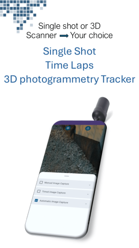
takes full-resolution images
single shot, timelapse, 3d tracker
integrated NTRIP client
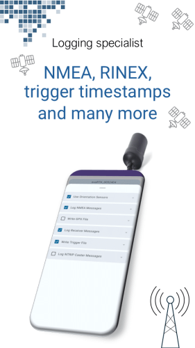
Logging in nmea, rinex, trigger timestamps, ...
no Cloud - retain legal control over your images
Features
- full resolution CAMERA to take geotagged photos even while walking
- USB and Bluetooth connections to external gnss antenna
- NTRIP client to receive RTCM correction data from RTK broadcaster
- coordinates are directly written into EXIF data and accuracy information into EXIF/XMP
- Logging of RTK GNSS track in NMEA style with GNGGA, GNRMC and GNGST message
- no Developer Mode and no Mock Location required. It's save an easy to use.
- Android 12+ required
- An external GNSS antenna/chip (like u-blox ZED F9P, Septentrio mosaic x-5) is required
Subscription, Pricing
The following features are available after subscription
- full coordinate precision lat/lon/elev resolution (free version limited to 5 digits lat/lon)
- additional camera features like HDR, if available
- full Output options like logging for PPK and timestamps for triggers
1 month
€ 17.99
3 month
€ 47.99
12 month
€ 109.99
Compatible external GNSS antenna
Please be patient, right now we are testing. The following hardware products are approved:
- REDcatch Smartphone RTK
- Ardusimple Handheld Kit (increase rate to 10Hz, add $GNGST message)
- GNSS store - ublox F9P (breakout board, via USB, conf. 10Hz and $GNGST)
- Emlid Reach RX
- Basically any Mosaic-X5 or ublox F9P chipset
- ... more to be tested.
- ... you tested? Please let us know and contact us! Thank you in advance
It’s not a matter of which products, but which connection parameters are configured with your external antenna. RTKcamera relies on NMEA messages ($GNGGA, $GNRMC, $GNGST) and RTCM3 messages for correction data handling.
FAQs
In RTKcamera, there are some function available for free. For example Logging the path in NMEA style or geotagging the full resolution photos with an accuracy of 5 digits for lat/lon. (Watch out for this limitation!)
With subscription, you can
- write 10 digits lat/lon directly into EXIF
- create a 50 millisecond accurate timestamp of the photo
- Log the RAW data for PPK
- Log the Ntrip casters station RTCM data
- and you enable us to enhance and further develop the App
Yes. You will need a subscription with a Correction data provider, or running your own base station which streams RTCM3 data to web.
YES! RTKcamera is the only App in the market providing all information for Postprocessing PPK fieldwork. Please note, that your external GPS antenna needs to configured the correct way (eg for ublox RAWX and SFRBX enabled). With REDtoolbox, you can PPK the path and geotag the images in one single step.
NO. RTKcamera App works without enabling Mock Location on your Smartphone. This brings major advantages in security and performance. We can handle 10Hz+ inside the App and therefor can geotag much more precisely compared bypass trough Android system.
RTKcamera does not require Mock Location. Following the reasons:
There is a potential for abuse and you can be vulnerable to attacks like spoofing or location based fraud. In addition to this security risks, mock location might be non-compliance with local regulations.
From technical perspective, Mock location is slow while updating and forwarding new positions into your Android system. This can lead into wrong coordinates, if you expect RTK precision while walking. And one more thing in addition: Mock location is not very user friendly.


